
So, let's talk about Traverse City - the cozy little nook where the Earth likes to kick back and relax. Why? Well, it's like the planet's spa day destination, especially when it's Earth Day.
Guardian of the Plover Galaxy
Tuesday, April 2, 2024 12:00 PM by Mike Kent

Alice Van Zoeren stands to watch on the sands of Sleeping Bear Dunes National Lakeshore. She has come to these shores for 17 years as a guardian. She searches to find, defend and protect the endangered bird known as the Piping Plover.
Traverse City Uncorked: A May Celebration
Thursday, March 28, 2024 3:00 PM by Traverse City Tourism

May is Michigan Wine Month. Join in on Northern Michigan’s month-long event: Traverse City Uncorked. Plan a tour spanning the nearly fifty local wineries and sip award-winning wines made with grapes grown on the 45th parallel. Savings, prizes, and special offers await.
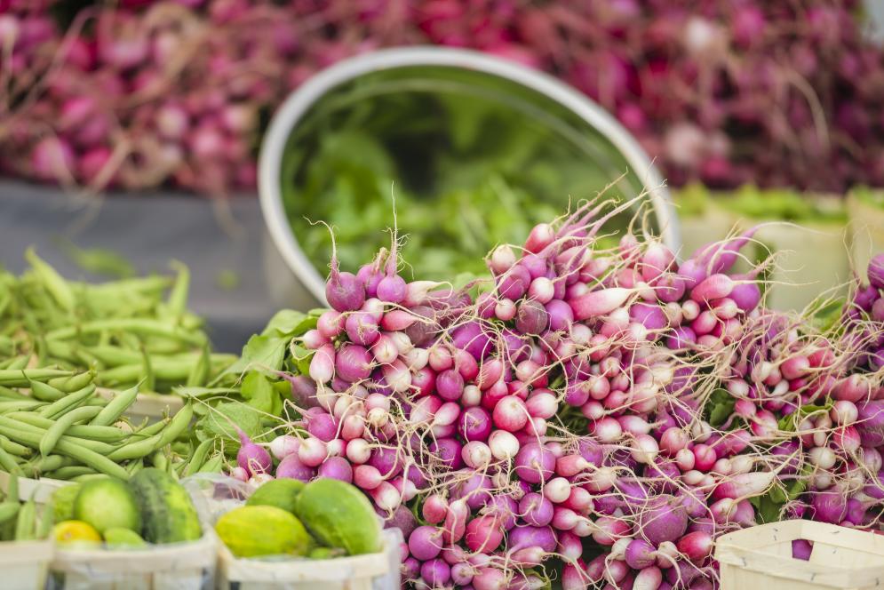
7 Michigander must-dos in Traverse City
Tuesday, March 26, 2024 5:00 PM by Traverse City Tourism

Yay! It’s officially spring. Over the next several months there will be lots of days full of sunshine and swimming, beaches and boating, festivals and fall color, hiking, biking, fishing, golfing...the list could go right through to next winter.
With so many ways to experience the beauty of Michigan’s upcoming seasons, it can help to make a list. So, here are seven classic activities for a healthy dose of Mitten State fun:
Historic Women in Traverse City
Thursday, March 14, 2024 2:00 PM by Mike Kent

March is Women’s History Month, for Traverse City Tourism it seems a perfect time to pay homage to three women who are charged with preserving the rich history of northern Michigan.
5 ways to make the most of spring in Traverse City
Tuesday, March 12, 2024 1:00 PM by Traverse City Tourism

May is Michigan Wine Month. It also happens to be the peak bloom for cherry blossoms in the Traverse City area. Combine those two occasions and you’ve got the perfect recipe for one of springtime’s most anticipated events: TC Uncorked.
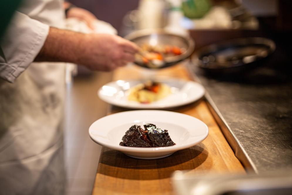
A Healthy Vegan Meal Plan in Traverse City
Friday, March 8, 2024 11:00 AM by Claire Butler
Headed ‘up north’ but worried about keeping options that align with your eating habits? Good eats with wellness in mind are easy to find in Traverse City, and those who partake in healthful choices or vegan eating won’t be left behind.
Check out our suggestions for a day of great bites:
Creativity Shines During Traverse City Restaurant Week
Wednesday, February 28, 2024 11:00 AM by Mike Kent
The culinary experience in the area is remarkable all year long, but during Traverse City Restaurant Week (TCRW), the eateries go into hyperdrive. Chefs experiment with different combinations. Items appear on the menu where they’ve never been before and may never show up again. Flavor combinations get ready to dance on your taste buds. There is energy and excitement at nearly 50 participating locations.
Your Guide to the National Cherry Festival
Thursday, February 15, 2024 4:00 PM by Charlotte Inda

Since 1925, the National Cherry Festival has been eight days of food, fun, family-friendly activities, and entertainment, all topped with a cherry of course. This event is a vibrant celebration that pays homage to our region's rich cherry-growing heritage.
With over 100 events, it’s hard to pick just one to attend. From the premier performers rocking out on the Bayside Music Stage to Arnold's Amusements Midway at the corner of Grandview Parkway and Union Street, there is something for everyone to enjoy.
A Very Cherry February!
Friday, February 2, 2024 9:00 AM by Hannah Schramski
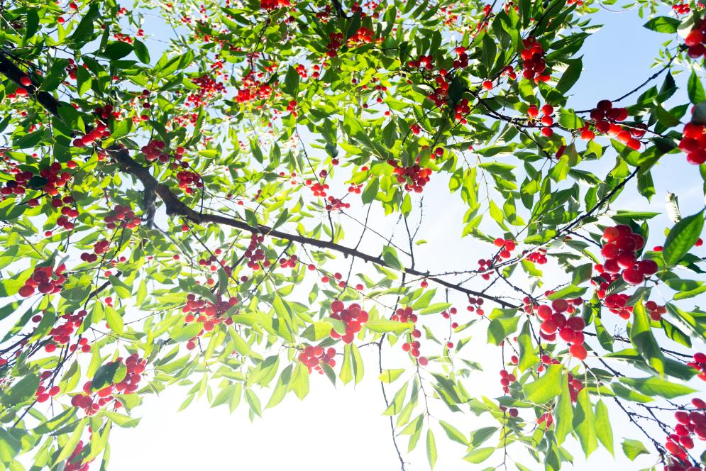
When you think of Traverse City, Michigan, what is the first thing that comes to mind? For many, the answer is the fruit that crowned Traverse City the “Cherry Capital of the World.” The state of Michigan produces over 70% of the national tart cherry crop annually, and the Grand Traverse region is especially suited for cherry production. This is due to its proximity to Lake Michigan, which provides a moderating effect on the local climate in addition to the area’s fertile, well-draining soil. Lake Michigan abates the icy winter winds and cools the cherry trees during the hot summer months, resulting in insulation from seasonal temperature drops and increases that would otherwise negatively impact cherry cultivation.
